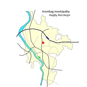
| Arambagh Municipality | |
|---|---|
| Type | |
| Type | Municipality |
| History | |
| Founded | 1886; 139 years ago (1886) |
| Leadership | |
| Chairman | Samir Bhandari |
| Vice Chairman | Mamata Mukherjee |
| Structure | |
| Seats | 19 |
| Political groups | AITC: 18 seats |
| Elections | |
| Last election | 2022 |
| Next election | 2027 |
| Website | |
| www | |
Arambagh Municipality is the civic body that governs Arambag and its surrounding areas in Arambagh subdivision of Hooghly district, West Bengal, India.
History
Arambagh Municipality was established in 1886.
Geography

Arambagh Municipality covers an area of 117.20 sq km and has a total population of 66,175 (2011).
Healthcare
Arambagh Subdivisonal Hospital, with 250 beds, is located in the Arambagh Municipality area.
Elections
In the 2022 municipal elections for Arambagh Municipality Trinamool Congress won 18 seats and BJP won 1 seat
In the 2015 municipal elections for Arambagh Municipality Trinamool Congress won all 19 seats.
In the 2010 municipal elections for Arambagh Municipality Trinamool Congress won 9 seats, CPI (M) 7 seats, Forward Bloc 1 seat and Independent 1 seat.
About the 2010 municipal elections, The Guardian wrote, "Today's municipal elections are unlike any for decades: the Communists, who have held West Bengal's main towns almost without a break since the 1970s, are facing disaster… This time defeat is likely to be definitive and could signal the beginning of the end for the Communist Party of India-Marxist (CPIM)."
In the 2005 municipal elections for Arambagh Municipality, CPI (M) won 11 seats, CPI 1 seat, Forward Bloc 3 seats and others 3 seats.
References
- "Arambagh Municipality". JNNURM. Retrieved 14 July 2017.
- "Arambagh Municipality". Hooghly district information. Hooghly district authorities. Archived from the original on 20 July 2017. Retrieved 14 July 2017.
- "2011 Census – Primary Census Abstract Data Tables". West Bengal – District-wise. Registrar General and Census Commissioner, India. Retrieved 15 July 2016.
- "Health & Family Welfare Department". Health Statistics. Government of West Bengal. Retrieved 15 July 2017.
- "Municipal General Election Results". Results of Municipal General Elections 2015. West Bengal State Election Commission. Retrieved 14 July 2017.
- "Municipal General Election Results". Results of Municipal General Elections yearwise. West Bengal State Election Commission. Retrieved 11 July 2017.
- Burke, Jason (29 May 2010). "India's Communist party faces defeat in West Bengal heartland". The Guardian, International Edition, 30 May 2010. Retrieved 14 July 2017.
- "Municipal General Elections 2005". District Hooghly. Hooghly district administration. Retrieved 19 July 2017.
| Hooghly district topics | |||||||||
|---|---|---|---|---|---|---|---|---|---|
| General | |||||||||
| Subdivisions | |||||||||
| Territories | |||||||||
| Municipal corporations and municipalities |
| ||||||||
| Community development blocks |
| ||||||||
| Rivers | |||||||||
| Transport | |||||||||
| Railway stations | |||||||||
| Institutes of higher learning | |||||||||
| Lok Sabha constituencies | |||||||||
| Vidhan Sabha constituencies | |||||||||
| Former Vidhan Sabha constituencies | |||||||||
| See also | |||||||||
Category: