| Amambai | |
|---|---|
| Municipality | |
 | |
 Flag Flag | |
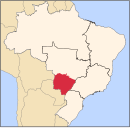
 Location in Mato Grosso do Sul state Location in Mato Grosso do Sul state | |
 | |
| Coordinates: 23°06′14″S 55°13′33″W / 23.10389°S 55.22583°W / -23.10389; -55.22583 | |
| Country | Brazil |
| Region | Central-West |
| State | Mato Grosso do Sul |
| Area | |
| • Total | 4,202 km (1,622 sq mi) |
| Population | |
| • Total | 39,826 |
| • Density | 9.5/km (25/sq mi) |
| Time zone | UTC−4 (AMT) |
Amambai is a municipality located in the Brazilian state of Mato Grosso do Sul. Its population was 39,826 (2020) and its area is 4,202 km.
References
| Capital: Campo Grande | |||||||||
| Mesoregion Centro Norte de Mato Grosso do Sul |
|  | |||||||
| Mesoregion Leste de Mato Grosso do Sul |
| ||||||||
| Mesoregion Pantanal Sul Mato-Grossense |
| ||||||||
| Mesoregion Sudoeste de Mato Grosso do Sul |
| ||||||||
This Mato Grosso do Sul, Brazil location article is a stub. You can help Misplaced Pages by expanding it. |