| Al Bir البير | |
|---|---|
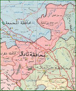
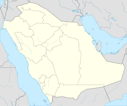
 Map illustrates Thadig region and shows Al bir location Map illustrates Thadig region and shows Al bir location | |
 | |
| Coordinates: 25°17′18″N 45°57′19″E / 25.28833°N 45.95528°E / 25.28833; 45.95528 | |
| Country | |
| Emirate | Ar Riyad Province |
| Area | Thadig |
| Elevation | 700 m (2,300 ft) |
| Time zone | UTC+3 (AST) |
| Area code | +9666 |
| Website | www.al-bir.com |
Al Bir (ar:البير) is a village in Saudi Arabia, and a village of Al-Mehmal area (Known nowadays as Thadig), which is one of the populous urban areas in Riyadh region. A Historical village, which is located in central region of Saudi Arabia 120 km (75 Miles) North of the capital city of Riyadh.
In urban view, Al Bir is one of the most old village in Al-Mehmal area. Furthermore, some historians believes that it was originally a source of ground water. In addition, some believes the village was part of Muslims pilgrims path to Holly city of Makah, especially pilgrims coming from the eastern part of Arabian Peninsula.
Al Bir was founded in 1015 Hijri ( around 1606 AD) when Al- Duwasir tribe ( precisely Al- Honaihen) moved to the area.
Al-Honaihen, namely; Mohammad and his brother Abdullah, took over Al Bir town from AlErinat, and they established their presence and their offspring.
Al bir enjoys a quiet peaceful green location, with mountains and hills surrounding it, as if protecting the town from the desert. its geographical location gathers rain water from the regions around it. after rain fall, the town blooms with greenery and flowers of different kinds.
See also
25°18′N 45°58′E / 25.300°N 45.967°E / 25.300; 45.967
| 1,000,000 and more | |
|---|---|
| 300,000-999,999 | |
| <300,000 | |
| Source: cdsi.gov.sa | |
| Capital: Riyadh | |
This article about the geography of Saudi Arabia is a stub. You can help Misplaced Pages by expanding it. |