| Abramovka Абрамовка | |
|---|---|
| Selo | |
  | |
| Coordinates: 48°59′N 131°29′E / 48.983°N 131.483°E / 48.983; 131.483 | |
| Country | Russia |
| Region | Jewish Autonomous Oblast |
| District | Obluchensky District |
| Population | |
| • Total | 1 |
| Time zone | ] |
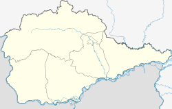
Abramovka (Russian: Абрамовка) is a rural locality (a selo) in Izvestkovskoye Urban Settlement of Obluchensky District, Jewish Autonomous Oblast, Russia. The population was 1 as of 2010.
Geography
The village is located on Trans-Siberian Railway, 52 km east of Obluchye (the district's administrative centre) by road. Snarsky is the nearest rural locality.
References
- Карта села Абрамовка в Еврейской автономной области
- "Статья 6. Распространение информации о точном значении времени и календарной дате / КонсультантПлюс | Федеральный закон от 03.06.2011 N 107-ФЗ (ред. от 22.11.2016) "Об исчислении времени", статья 5". consultant.ru. Retrieved 2018-08-29.
- "Итоги Всероссийская перепись населения 2010 года по Еврейской автономной области. Численность населения по области, городскому округу, муниципальным районам, городским и сельским поселениям, городским населённым пунктам, сельским населённым пунктам" (PDF). Archived from the original (PDF) on 2018-04-04. Retrieved 2018-08-29.
- Расстояние от Абрамовки до Облучье
This Jewish Autonomous Oblast location article is a stub. You can help Misplaced Pages by expanding it. |