 A171
A171 | ||||
|---|---|---|---|---|
 | ||||
| Route information | ||||
| Length | 48.1 mi (77.4 km) | |||
| Major junctions | ||||
| North end | Middlesbrough 54°34′29″N 1°12′12″W / 54.5748°N 1.2033°W / 54.5748; -1.2033 (A171 road (northwestern end)) | |||
| Major intersections | ||||
| South end | Scarborough 54°16′49″N 0°24′19″W / 54.2804°N 0.4053°W / 54.2804; -0.4053 (A171 road (southeastern end)) | |||
| Location | ||||
| Country | United Kingdom | |||
| Primary destinations | Whitby | |||
| Road network | ||||
| ||||
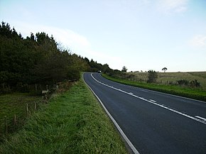
The A171 is a road in England that links the North Yorkshire towns of Middlesbrough, Guisborough, Whitby, Robin Hood's Bay and Scarborough. Locally it is known as The Moor Road. The road is mostly single carriageway but has some sections of dual carriageway. The distance between the two towns is 47 miles (75 km)
Description
The road starts on the A66 at Middlesbrough (South Bank) and heads south east through Ormesby to Nunthorpe where it turns east as a dual carriageway for 3.5 miles, before becoming a single carriageway again that bypasses Guisborough. Just outside Guisborough it heads into the North York Moors National Park (forming its boundary at first). After passing the village of Charltons, it rises up at a 15% incline through two 90° turns (the first east then the second south) up to Low Moor, this hill is named Birk Brow.
The road then wends its way through the open moorland of the North York Moors park past Scaling Dam and down into Whitby where it heads across Whitby new bridge. The bridge was built in 1980 at a projected cost of £1 million but the final amount was closer to £2 million.
The road then heads mostly in a south easterly direction out of Whitby bisecting Low & High Hawsker and then into open moorland again until it reaches the village of Cloughton where the National Park ends. It then heads due south through Burniston and Scalby before finishing in Scarborough at a junction with the A64 on Falsgrave Road.
Bus services
The route is served by Arriva bus service X93/X94. During the summer part of the timetable (which is the end of March to the start of November) the service, for most of the day, is one bus every half hour in each direction.
A Park and Ride facility was opened at the junction with the B1460 outside of Whitby in 2014. The park has space for 450 vehicles and buses run every 15 minutes to and from the town between the hours of 10 am and 7 pm.
War monument
At the roundabout junction with the A169 is a monument to the first German aircraft shot down over England in the Second World War. Three Hawker Hurricane aircraft of 43 Squadron, RAF Acklington shot down a Heinkel He 111 at Bannial Flat Farm just north of what is now the two A roads junction.
References
- The Rough Guide to Yorkshire. Rough Guides. 1 April 2011. p. 224. ISBN 978-1-84836-603-9.
- Somerville, Christopher (4 February 2006). "Walk of the month". The Daily Telegraph. Retrieved 22 August 2019.
- "The New Bridge At Whitby - Real Whitby Forums - The Busiest Community Site In Whitby". Real Whitby Forums - The Busiest Community Site In Whitby. Archived from the original on 5 February 2015. Retrieved 12 October 2015.
- Armstrong, Judy; Bibby, Andrew (1 March 2006). Freedom to Roam The North York Moors. Frances Lincoln ltd. p. 136. ISBN 978-0-7112-2556-5.
- Arriva Bus service X93 Middlesbrough to Scarborough (PDF). Arriva Bus. Retrieved 12 October 2015.
- "Whitby and Esk Valley Transport Strategy" (PDF). northyorks.gov.uk. December 2009. p. 8. Archived from the original (PDF) on 24 November 2022. Retrieved 2 October 2018.
- "Park-and-ride scheme opens in Whitby". BBC News. Retrieved 1 November 2015.
- "Heinkel He 111 near Whitby". yorkshire-aircraft.co.uk. Retrieved 1 November 2015.
Download coordinates as:
| A roads in Zone 1 of the Great Britain road numbering scheme | ||
|---|---|---|
54°28′16″N 0°46′33″W / 54.4712°N 0.7757°W / 54.4712; -0.7757 (A171 road)
This England road or road transport-related article is a stub. You can help Misplaced Pages by expanding it. |