| Revision as of 09:19, 10 July 2011 editFrazzone (talk | contribs)6,563 editsm →External links: +it← Previous edit | Revision as of 04:40, 16 August 2012 edit undoHmainsbot1 (talk | contribs)Bots120,826 editsm →History: AWB general fixes and delink dates per WP:DATELINK, WP:YEARLINK and MOS:UNLINKYEARS using AWB (8097)Next edit → | ||
| Line 4: | Line 4: | ||
| ==History== | ==History== | ||
| In ] the village was first mentioned in |
In ] the village was first mentioned in 1113. | ||
| ==Geography== | ==Geography== | ||
Revision as of 04:40, 16 August 2012

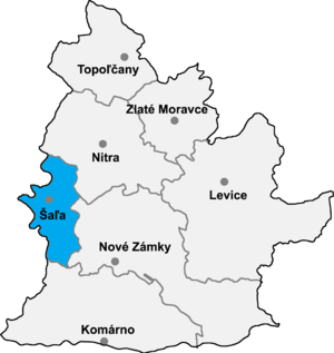
Kráľová nad Váhom (Template:Lang-hu) is a village and municipality in Šaľa District, in the Nitra Region of south-west Slovakia.
History
In historical records the village was first mentioned in 1113.
Geography
The village lies at an altitude of 121 metres and covers an area of 9.509 km². It has a population of about 1580 people.
Ethnicity
The village is about 84% Magyar, 16% Slovak
Facilities
The village has a public library, a DVD rental store a gym and a football pitch.
External links
| Municipalities of Šaľa District | ||
|---|---|---|
48°10′N 17°51′E / 48.167°N 17.850°E / 48.167; 17.850
This Nitra Region geography article is a stub. You can help Misplaced Pages by expanding it. |